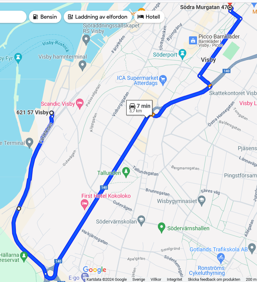
From the habor to Södra Murgatan 49. By car blue line. Note Summertime. Read directions further down. Walking red line.

By car 2.7 km about 7 minutes
- Follow the cars until you get through the "gates"
- There is a roundabout, drive in it and round into the Färjeleden (Ferry Trail) in a northerly direction
- Merge onto Gute Road first right running up the hill
- Up on the "top" at the traffic lights turn left into Söderväg
- Drive to the roundabout and the third exit (Solberga Gatan)
- Drive to next traffic light
- Turn left onto Peder Hardings Väg, drive to the first junction
- Turn right onto King Magnus Väg to the first crossing
- Turn left onto Skolgatan (School Street Port)
- Turn right arrive after 50 meters.
Walking 1.2 km about 15 minutes.
- Go towards the city, Färjeleden (Ferry Trail), on the right side old prison. Turn right immediately after the prison. Walk up the hill road
- Go straight up the stairs at the intersection Komendatbacken, Visborgsgatan. Continue up on Södertorg (South Square)
- Go left at the top of Södertorg.
- Go right about 50 meters on Adelgatan
- Turn right in to Södra Murgatan and follow the road to the goal.
Summertime the Gute road is closed. Use below direction information.

